Photography sparked the fantasy of creating a double of the planet whose images would cover the world, making it accessible to all. With the aim of leisure or education, this fantasy led to the creation of corpuses like the “Archives of the Planet”, created between 1909 and 1931 at the initiative of the philanthropist Albert Kahn, by operators who traveled the globe, bringing back 72,000 photos and 170,000 meters worth of films. But while these figures are striking, they’re nothing compared to the possibilities today offered by internet, Google Earth or Google Street View: all of the world’s landscapes, or very nearly, are accessible in a few clicks – perhaps to the point of rendering landscape photography, as practiced since the medium’s invention, obsolete.
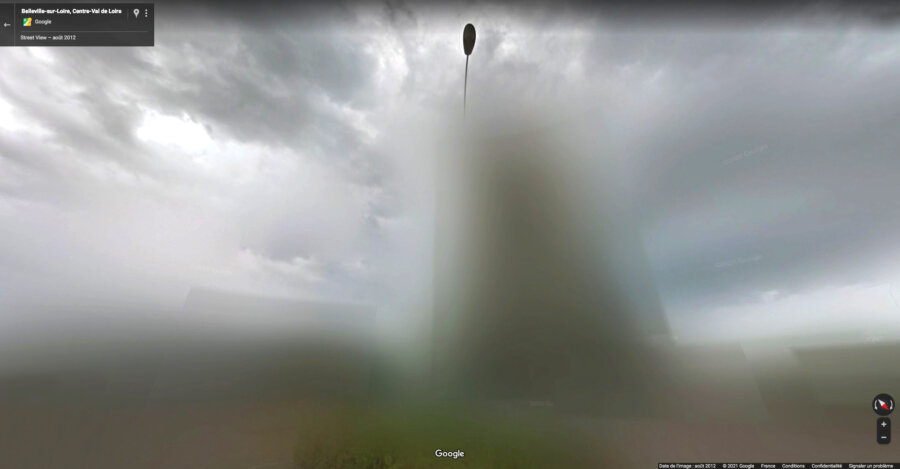
This is presumably proven by Deux visions by Caroline Delieutraz, a series begun in 2021 and continued today through this tutorial. It is composed of diptychs juxtaposing pages from La France de Raymond Depardon (2010) and screen shots from Google Street View taken in the same locations as Depardon’s photos. The images were made during the same period and using rather similar operating methods. Depardon began his project in 2004. He crisscrossed France in a truck, stopping to photograph the country from the road. Google Cars, equipped with a camera with multiple lenses, drove all around the country starting in 2008. Within a few years, the whole of its territory was covered. Depardon’s choice of method of course contrasts with the systematism of Google Cars. He sees things that cars can simply record. Nevertheless, his images are surprisingly close to the automatized and programed vision of Google Cars. In the post-photographic era, the world can also very well be traveled from home.
Étienne Hatt
A footprint-free imprint
Making an anthotype with Léa Habourdin